
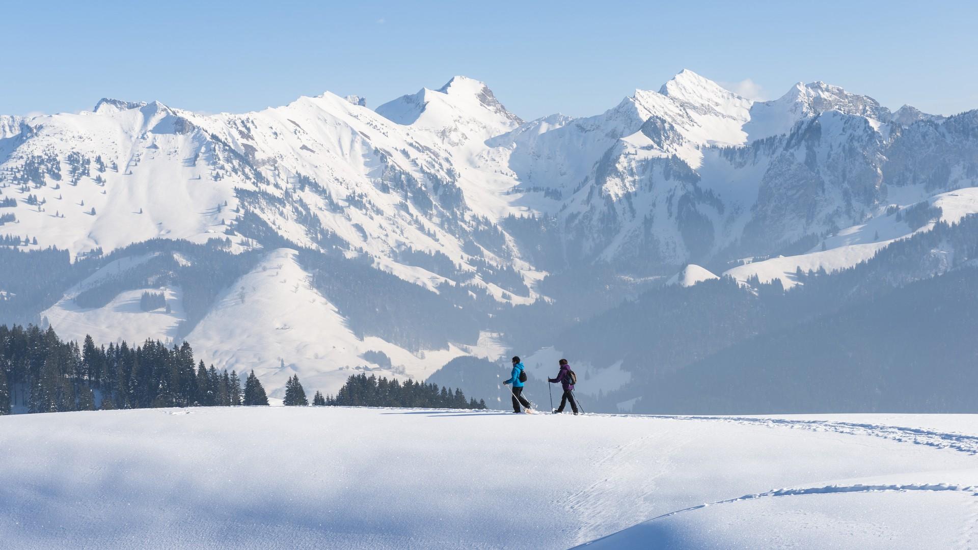
Do you fancy an energetic walk with a unique view? This route takes you through forests and clearings to the Cousimbert. The view from the Cousimbert alone is worth the walk.
SwitzerlandMobility: route 279
La Roche, Le Brand–La Berra
The route starts from the car park in Le Brand. Once you are standing in front of the main ski lift building, turn left and walk to the end of the car park. Strap on your snowshoes and off you go!
Follow the ski run in line with the ski tow and then leave the ski area to join the path that leads to the Cousimbert. You will find yourself in the wild natural environment between forests and trees so typical of the Pre-Alps – guaranteed to recharge your batteries. Once you arrive at the Chalet du Cousimbert in Remy, you can take your time enjoying the panoramic views on the stretch linking the Cousimbert to the La Berra peak. From the Lac de la Gruyère, flanked by the summit of the Gibloux, the Swiss plateau is lined by the long chain of the Jura, with the Chasseral rising to 1,607 m, the Moléson (2,002 m) and the Vanils chain separated by the Intyamon valley in the west, Vounetse and the Dents Vertes in the foreground to the south, with the Gros Brun (2,104 m), the Kaiseregg (2,185 m) and the Stockhorn, and finally a fine view over the Bernese Alps to the east.
Head back towards La Berra for a well-deserved break at alpine hut "Le Chalet". Descend via the cable car or continue on to the Gîte d’Allières and then walk back to the starting point.
Find in the "Download files" a complete description of the snowshoe trail to download, print and take with you during your hike.
Information
La Berra
La Berra
1634 La Roche
This unprepared itinerary is marked. You take this trail at your own risk.
Properties of the itinerarie
Type of activity: Sports
Difficulty: Very challenging
Duration: 02:55
Distance: 6 km
Ascent/Descent: +744m / -141m
Altitude min./max.: 1011m / 1717m